|
1844 |
© Reproduced by courtesy of Steve Batrick, Ross-on-Wye
|
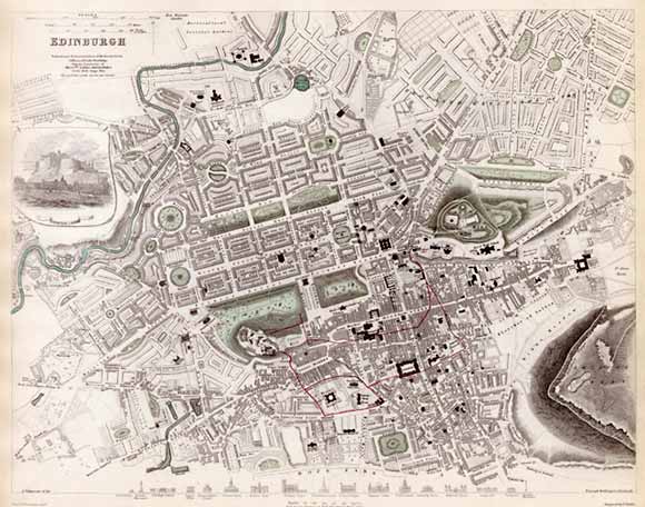
Edinburgh - 1844 |
|
This map was drawn by WB Clarke, Architect and engraved by E Turrell for the Society for the Diffusion of Useful Knowledge. The map includes plans that were never implemented. In particular, on the NE side of Edinburgh New Town) there is an area marked: "Proposed Extension of the City". This area on the map includes housing, streets and squares near Leith Walk at Pilrig. Some of these were never built. |
|
Please click here to see 16 sections of this map |
|
MAPS: Full index |
|
MAPS: Short Index with thumbnails |