c.1582
© For permission to reproduce, please contact peter.stubbs@edinphoto.org.uk
|
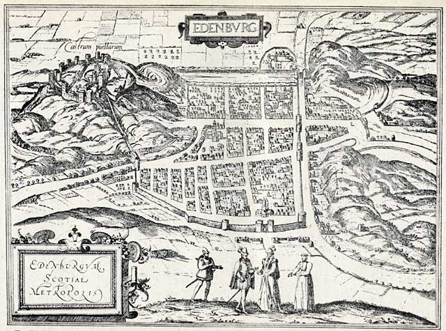
Edinburgh c.1582 |
|
This sixteenth century map of Edinburgh was published as map no. 4 in Vol 3 of Braun & Hogenburg's 6-volume work, Civitates Orbis Terrarum. It looks over the Old Town of Edinburgh, with the medieval town walls and five main gate. In the map above, the walls extend about twice as far to the south as those shown in the bird's-eye view of c.1460 |
|
The details above are taken from an article 'The Early Views and Maps of Edinburgh by William Cowan and Harry R G Inglis published in the Scottish Geographical Magazine, Vol XXXV, Published by the Royal Scottish Geographical Society, 1919. |
|
MAPS: Full index |
|
MAPS: Short Index with thumbnails |