Picture Plan - 1544
© For permission to reproduce, please contact peter.stubbs@edinphoto.org.uk
|
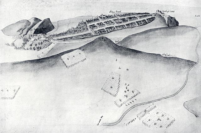
This plan has been carefully drawn and includes considerable detail. |
|
Picture Plan of Edinburgh 1544 |
|
This picture plan shows: - The Cowgate (the road at the top of the picture) - The Royal Mile ( the road running parallel), comprising:. - The Canongate from Holyrood Palace running through the borough of the Canongate to the Nether Bow Port, then - The High Street from the Nether Bow Port within the walls of Edinburgh to Edinburgh Castle. This is the earliest known fairly authentic view of Edinburgh. It illustrates an attack on the city, believed to be by the Earl of Hertford in 1544, whose English troops burnt most of the town. |
|
The details above are taken from an article 'The Early Views and Maps of Edinburgh by William Cowan and Harry R G Inglis published in the Scottish Geographical Magazine, Vol XXXV, Published by the Royal Scottish Geographical Society, 1919. |
|
MAPS: Full index |
|
MAPS: Short Index with thumbnails |