from the south
1670
© For permission to reproduce, please contact peter.stubbs@edinphoto.org.uk
|
Edinburgh from the South 1670 |
|
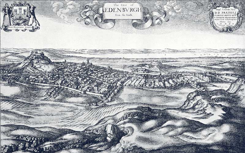
The View The famous engraver, Hollar, produced this picture of Edinburgh from the south (above) showing Edinburgh Castle high on its rock at the left of the picture - below the Edinburgh Coat of Arms with its legend: 'Nisi Dominus Frustra'. At the right-hand side of the picture, at the foot of the Royal Mile leading down the hill from Edinburgh Castle, is Holyrood Palace. Calton Hill is in the centre of the picture. The Firth of Forth is in the background, with shipping gathering around Leith Harbour and the Island of Inchkeith on the right. On the far shore of the Firth of Forth is the Kingdom of Fife. |
|
The Date Hollar's engraving plate is dated 1870, but it is thought to have been based on a drawing probably made some years earlier as some of the buildings shown were destroyed by Cromwell in 1650. William Cowan and Harry R G Inglis, 'The Early Views and Maps of Edinburgh', Scottish Geographical Magazine, Vol XXXV, Published by the Royal Scottish Geographical Society, 1919. Here is another view of Edinburgh from the south, this one dated c.1649 by the National LIbrary of Scotland Map Room. Some buildings are the same as on both maps. Others are different. |
|
MAPS: Full index |
|
MAPS: Short Index with thumbnails |