|
1840 This
map, by WH Lizars, appeared in the © Copyright: For permission to reproduce, please contact peter.stubbs@edinphoto.org.uk |
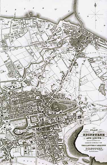
Edinburgh & Leith 1840 BOTTOM OF MAP: Edinburgh TOP RIGHT CORNER: Leith At first glance, comparing this map with the 1835 map, it appears that there has been considerable development. But on closer inspection it can be seen that the difference is mainly in the style of the mapping, rather than changes in the area being mapped. The 1840 map shows more detail. |
|
MAPS: Full index |
|
MAPS: Short Index with thumbnails |