|
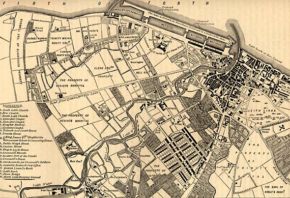
Leith - 1804 |
Engraving from Old & New Edinburgh - published 1890
Leith 1804
© For permission to reproduce, please contact peter.stubbs@edinphoto.org.uk
|
Leith - 1804 |
|
This map by John Ainslie, land surveyor, shows the ownership of land in Leith, Newhaven and Trinity in 1804, together with plans for proposed new docks at Leith. |
| Leith |
|
Old Maps: 1693 1804 1835 1840 1860 1917 Small Maps: 1870 1915 1925 1940 1955 Large Maps: 1870 1915 1925 1940 1955 Aerial View: 2001 |
|
Engravings Thumbnail images |
||