|
1804 |
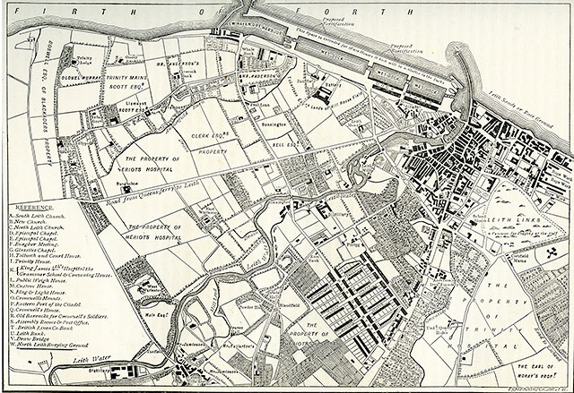
Plan of Leith showing the Proposed New Docks, 1804
(By John Ainslie, Land Surveyor)
© For permission to reproduce, please contact peter.stubbs@edinphoto.org.uk
|
Enlarge this Map |
|
Leith - 1804 |
|
This map by John Ainslie, land surveyor, shows the ownership of land in Leith, Newhaven and Trinity in 1804, together with plans for proposed new docks at Leith. The map has been taken from an engraving in the book 'Old & New Edinburgh', published around 1890. |
| Leith |
|
Old Maps: 1693 1804 1835 1840 1860 1917 Small Maps: 1870 1915 1925 1940 1955 Large Maps: 1870 1915 1925 1940 1955 Aerial View: 2001 |
|
Engravings Thumbnail images |
||