|
Boswall Drive |
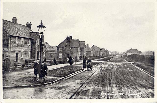
Looking north along Boswall Drive
from the junction with Boswall Avenue
1920s
© For permission to reproduce, please contact peter.stubbs@edinphoto.org.uk
Looking north along Boswall Drive
from the junction with Boswall Avenue
2004
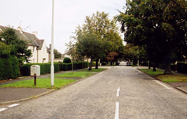
© Peter Stubbs peter.stubbs@edinphoto.org.uk Photograph taken: 22 September 2004
|
Boswall Drive |
|
Two Views The two views look to the north along Boswall Drive from a point close to the railway bridge. In both views there is little traffic to be seen. In the top picture, houses can be seen along the western side of Boswell Drive and the bowling club clubhouse can be seen in the distance on the right. All these buildings are still standing but most are now hidden behind trees. In the foreground on the
left is the junction with Boswall Avenue. The houses closest on the left
in both photos are 14 and 16 Boswall Drive. |
|
History The Boswall estate was built at the start of the 1920s. Boswall Drive and most other roads on the estate were given their names in November 1921. [History and Derivation of Edinburgh Street Names: Edinburgh Corporation City Engineers Dept, 1975] This photo seems likely to have been taken shortly after the houses were built. At first glance it appears that none of the houses on the right-hand side of the road have yet been built, but they are well set back from the road, so perhaps some have been built and are out of the picture. This scene looks rather bare. The trees and hedges that now line the road have still to be planted and the road is covered in slushy snow, but there seem to be plenty of people willing to pose for the photographer. The attractive gas lamp posts were replaced many years ago by taller lamp posts for electric lights, and a not-very-attractive 'box on pole' for use as storage by postmen was installed near the Boswall Avenue corner more recently. |
|
The Postcard The publisher of this postcard and the photographer are not named, and the card has not been sent through the post. There were also other cards in and around the district in this series, including one of Fraser Avenue: Fraser Avenue |
|
North Edinburgh Cramond - Granton - Royston - Trinity - Wardie |
|
|
Maps Granton: transport map 1932 Granton: small map 1870 Granton: large map 1870 |
Recollections Cramond: from 1940s Cramond Island: 1970s Granton: 1930s 1940s 1950s 1970s Granton, Trinity, Wardie: 1940s 1950s - 60s Shops Lower Granton Road all dates Muirhouse from 1930s Pilton: 1940 bomb Royston: from 1930s |
|
History Granton, Trinity, Wardie: from 1544 |
|