|
The National Galleries |
|
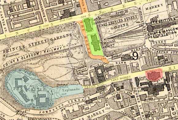
The map below shows Edinburgh in 1870. The street lay-out is the same today, over 130 years later. The Old Town Edinburgh Old Town is in the lower portion of this map. The Royal Mile runs from the Castle, lower left corner, to Holyrood Palace, just off the map. There are narrow lanes or closes on either side of the Royal Mile. The New Town By contrast, the New Town, with its regular pattern of broad streets, can be seen top-left. It was in the New Town that many of Edinburgh's professional photographers set up their studios in Princes Street. The Photographic Society of Scotland and Edinburgh Photographic Society also held their meetings in the New Town, in George Street and Queen Street. |
Central Edinburgh - 1870
|
|
© Copyright: For permission to reproduce, please contact peter.stubbs@edinphoto.org.uk
|
YELLOW = Princes St and the Royal Mile ORANGE= Hanover St and the Mound GREEN = National Galleries BLUE = Edinburgh Castle RED = St Giles Church |