|
St Leonard's District Photos Photo 9
The Rear of |
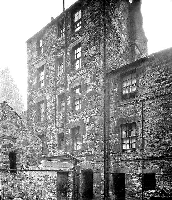
© Reproduced with acknowledgement to David Gordon, Old Town, Edinburgh
showing where the photograph above was taken from
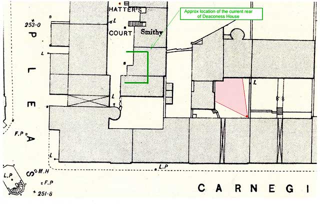
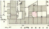
Bartholemew map revised 1891, based on Ordnance Survey maps surveyed 1876-77
© Reproduced by permission of the Trustees of the National Library of Scotland.
showing where the photograph above was taken from
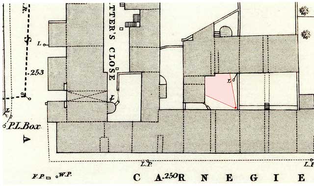
Ordnance Survey maps surveyed 1876-77
© Reproduced by permission of the Trustees of the National Library of Scotland.

|
St Leonard's District - 1920s |
|
Collection of Photos The image above is taken from a collection of whole-plate negatives. The photos were probably taken around the 1920s. If you recognise this street, please email me. Thank you. Peter Stubbs: July 4, 2008 |
|
Reply 1. John Hadden Edinburgh |
Thank you to John Hadden for annotating a copy of an 1891 Bartholemew map and an 1876 Ordnance Survey map to show where he believes that the photo above might have been taken from. |
|
John wrote: The Rear of Carnegie Street "I just thought I'd take a fresh look at the outstanding mystery pictures again :) What struck me this time was the style of the stonework on the gable that can be seen in the background. The style looks somehow familiar and so I suspect it could be part of a building that still exists, especially as it looks in good condition and so may not have been demolished since. Considering the possible buildings in the area, I was wondering about the Deaconess Hospital as a possible candidate. On the aerial photos, there is a gable at the rear of the present building (currently renamed as Deaconess House), without any windows, that may be the wall seen in the background of this photo. I've marked the possible location of this photo on both of the maps above. The 1876 map also indicates the position of the passage shown in the photo. (Dotted lines indicate covered passages.) John Hadden, Edinburgh: January 4, 2009 |
|
1891 Map Carnegie Street, and the houses to the rear of the street, can be seen near the top of the St Leonard's 1891 map below. |
|
More photos - Questions and Answers: Where is it? |
||