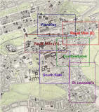
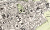
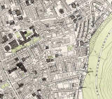
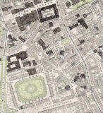
Edinburgh Old Town

 South Side

1891

South Side  -  1891

Small Map

Edinburgh Old Town  -  Extract from a Bartholemew Map, 1891  -  South Side

Bartholemew map revised 1891, based on Ordnance Survey maps surveyed 1876-77

 © Reproduced by permission of the Trustees of the National Library of Scotland.
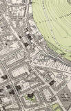
 

Enlarge this map

    Edinburgh Old Town  -  Extract from a Bartholemew Map, 1891  - South Side ©


1891 Map

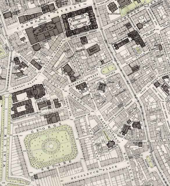
South Side

Several  Edinburgh University buildings are located in the South Side of Edinburgh.  These include buildings around the old residential square, George Square in the lower-left corner of this map.

The Museum of Science & Art can be seen near the upper-left corner of this view.  This has now become the Royal Museum of Scotland.  A Museum of Scotland has now been built to the west of it in Chambers Street.

Other extracts from this Map

To see more extracts from this 1891 map, please click on one of the links below.


Edinburgh Old Town

1891 Map

1891 Map  -  Edibnburgh Old Town  -  map + key ©

Old Town

small

medium

PLEASE NOTE:  Large maps below may take a while to load and
 you'll need to scroll across and down to see the whole extract.

Edinburgh Old Town  -  Extract from a Bartholemew Map, 1891  -  Waverley ©

Waverley

small

medium

large

Edinburgh Old Town  -  Extract from a Bartholemew Map, 1891   -  Royal Mile (west) ©

Royal Mile (W)

small

medium

large

 Edinburgh Old Town  -  Extract from a Bartholemew Map, 1891  -  Royal Mile (east) ©

Royal Mile (E)

small

medium

large

Edinburgh Old Town  -  Extract from a Bartholemew Map, 1891  -  South Side ©

South Side

small

medium

large

Edinburgh Old Town  -  Extract from a Bartholemew Map, 1891  -  Dumbiedykes ©

Dumbiedykes

small

medium

large

Edinburgh Old Town  -  Extract from a Bartholemew Map, 1891  -  St Leonard's ©

St Leonard's

small

medium

large

Detail from 1891 Map  -  Edinburgh Gas Works, New Street ©

Edinburgh Gas Works


__________________