|
Edinburgh Dumbiedykes |
|
Early Maps |
|
|
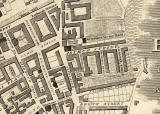
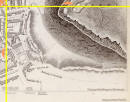
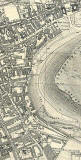
c. 1820 |
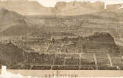
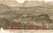
c. 1821 |
|
Engraving showing the position of Dumbiedykes |
|
|
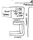
Sketch |
|
Maps and Aerial Photograph |
||
|
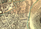
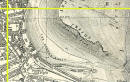
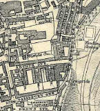
1844 |
1925 |
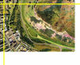
2001 |
|
Please click on any of the images above. All three will appear on the same page. |
||
|
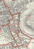
Link to 1852 Map |
|
Thank you to Bob Henderson for telling me about this map. Bob wrote: |
|
Dumbiedykes under Construction "In my search for more information about St Pat's school, I found this 1852 map. It shows that Arthur Street, Westy and Middly had been built, but there was not yet an Eastie, any of the Prospects or any buildings near Dumbiedykes Road. Bob Henderson, Burdiehouse, Edinburgh: January 15, 2011 |
|
Please click on the link below to view this map on the NLS web site. (Hold down the space bar and use the left mouse button to scroll around the map.) |
|
MAPS: Full index |
|
MAPS: Short Index with thumbnails |