|
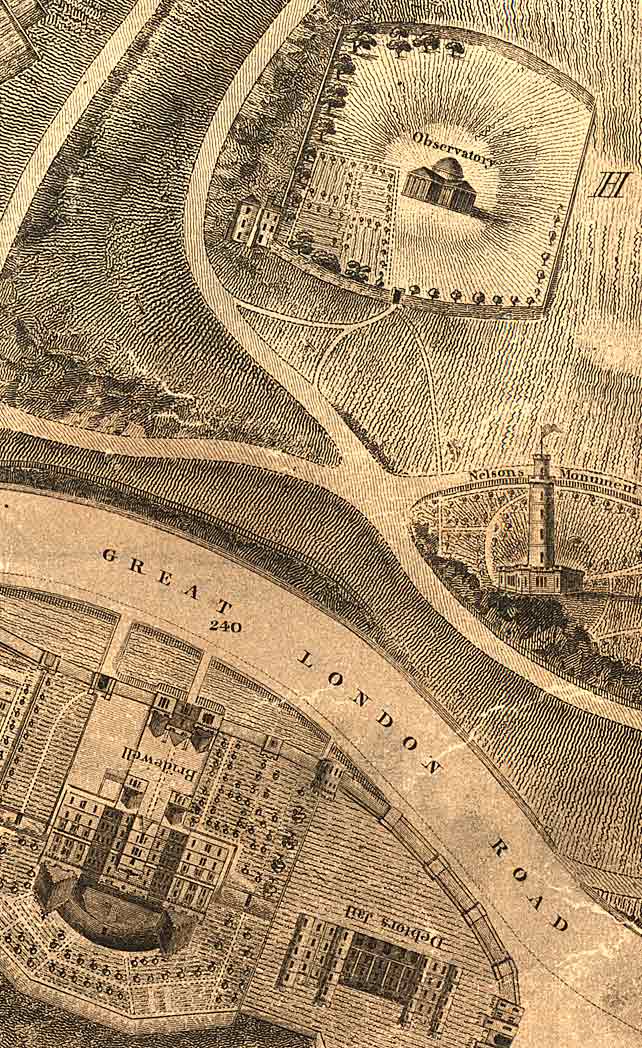
Edinburgh New Town - Robert Kirkwood Map Calton 1819 |
|
|
Calton Hill Monuments and Calton Jail and Bridewell
© Reproduced by courtesy of the National Library of Scotland. Click here for further info, and for the NLS maps web site. |
|
|
Click here to see all other sections of this map: |
Please click
an arrow below to move to a
|
|
Click here
to see the whole map
and aerial view:
|
|
|
Calton |
|
|
The map above shows: - TOP: Monuments on Calton Hill - BOTTOM: Calton Jail and Bridewell The 'Great London Road' (later to become the 'A1') lead can be seen here beneath the southern slopes of Calton Hill. This road started a short distance to the west at the East End of Princes Street, beside the Theatre Royal in Shakespeare Square (later to become the site for the GPO. The road led across the newly constructed Regent Bridge over Low Calton, then past Rock House, the studio of Hill & Adamson, before reaching the lower slopes of Calton Hill in this picture. The Jail and Bridewell were demolished in the early 20th century to make way for the building of the Government Offices, St Andrew's House. |
|
|
Kirkwood Map - 1819 |