Central Edinburgh
Early 1700s
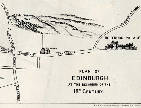
Netherbow to Holyrood
|
|
© Copyright: For permission to reproduce, please contact peter.stubbs@edinphoto.org.uk
|
|
|
1700s This section of the map covers the Netherbow, close to the left hand side of this map (where the city wall once crossed the Royal Mile) to Holyrood. This, being outside the City Walls of Edinburgh, was a separate borough - Canongate. |
|
MAPS: Full index |
|
MAPS: Short Index with thumbnails |