|
Hutchison Crossway A road (in two parts) between Gorgie Road and Slateford Road |
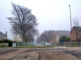
The Northern End of Hutchison Crossway - at Gorgie Road
© Steven Oliver, Duns, Borders, Scotland
|
Hutchison Crossway |
|
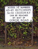
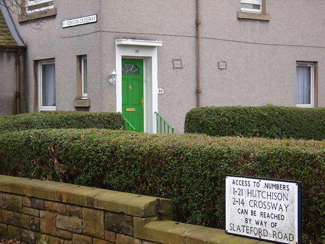
Steven Oliver, Duns, Borders, Scotland, explains: "If you look at a street map, at first glance, it looks as if Hutchison Crossway has been closed off in the middle at some point. That isn’t (and has never been) the case, as was confirmed to me by a friend who was brought up in the area. Hutchison Crossway was built in two sections, linked by a footbridge. The sections were:: - from Gorgie Road to the railway line, and - from the railway line to Hutchison Road and on Slateford Road. At some point, after the closure of the railway line, the Fruit Market was built, and the section of Hutchison Crossway leading from Gorgie Road was extended to the former railway line to provide access to it where the footbridge used to be. Here it met the section running from Slateford Road. But a wall was built (now a fence) to separate the two sections of the street to prevent vehicles from using it as a short cut. A gap was provided for pedestrians. At the Slateford Road end of Hutchison Crossway, there is this sign: At the Gorgie Road end of Hutchison Crossway, there is this sign: Rather oddly, the street lights also provide a clue to the history of the street. The section from Gorgie Road to the old railway line has lampposts more usually found on main roads, while the section from there to Slateford Road has residential street lighting. Additionally, the north section is wider than the south section." |