|
St Leonard's District Photos
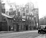
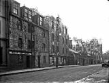
Photo 14 Pleasance |

© Reproduced with acknowledgement to David Gordon, Old Town, Edinburgh
|
St Leonard's District - 1920s |
|
Car in Pleasance This view looks to the north down Pleasance towards the junction with East Richmond Street. The registration number of the car parked beside the pavement is 'SF2420'. I believe this number was issued around the mid-1920s. |
|
Collection of Photos The image above is taken from a collection of whole-plate negatives. The photos were probably taken around the 1920s. |
|
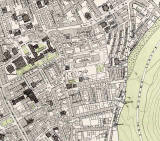
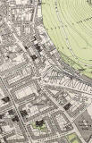
1891 Maps Pleasance can be found running down the centre of the Dumbiedykes map and in the top-left corner of the St Leonard's map below. |