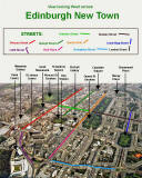
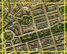
Edinburgh

New Town

1st New Town

The 1st New Town of Edinburgh was created in the late 18th century.  It includes:

-  Princes Street, George Street and Queen Street,  all running east-west.
-  Charlotte Square and St Andrew Square at either end of George Street.
-  Royal Circus and Moray Place, two elegant circles, further to the NW.

2nd New Town

The 2nd New Town is a mid 19th century extension of the 1st New Town, towards:

-  Canonmills, in the valley to the north of Princes Street.
-  Broughton, to the north-west of Princes Street.


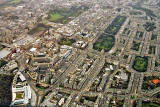
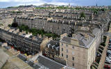
Oblique Aerial Photograph

Edinburgh New Town

View looking West from Calton

Aerial Photograph  -  Looking to the West across Edinburgh New Town  -  6 December 2003 ©

2003

View

Aerial Photograph  -  Looking to the West across Edinburgh New Town  -  6 December 2003 ©

2003

View with Key


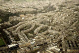
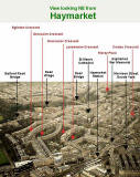
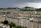
Oblique Aerial Photograph

Edinburgh New Town

View looking NE from Haymarket

Looking down on Haymarket  -  View to the north-east towards Dean  -  6 December 2003 ©

2003

View

Looking down on Haymarket  -  View to the north-east towards Dean  -  6 December 2003 ©

2003

View with Key


Looking across Edinburgh New Town to Arthur's Seat

from the tower of St Stephen's Church

View from the top of the tower at St Stephen's Church, Stockbridge, looking SE - 2010 ©

©


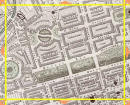
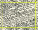
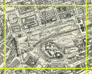
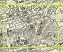
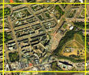
Maps and Vertical Aerial Photograph

1st New Town  (North)

Edinburgh  -  1844  -  Map produced for the Society for the Dissemination of Useful Knowledge  -  Section F ©

1844

Edinburgh Map  -  1925  -  Section F ©

1925

Aerial Photograph  -  2001  -  Section F ©

2001

Please click on any of the images above.  All three will appear on the same page.


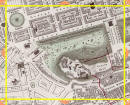
Maps and Vertical Aerial Photograph

1st New Town (South)

Also:  Princes Street Gardens (west) and Edinburgh Castle

Edinburgh  -  1844  -  Map produced for the Society for Dissemination of Useful Knowledge  -  Section J ©

1844

Edinburgh Map  -  1925  -  Section J ©

1925

Aerial Photograph  -  2001  -  Section F ©

2001

Please click on any of the images above.  All three will appear on the same page.


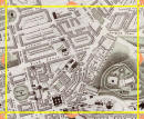
Maps and Vertical Aerial Photograph

2nd New Town (Broughton)

Also:  Calton Hill

Edinburgh  -  1844  -  Map produced for the Society for the Dissemination of Useful Knowledge  -  Section G ©

1844

Edinburgh Map  -  1925  -  Section G ©

1925

Aerial Photograph  -  2001  -  Section G ©

2001

Please click on any of the images above.  All three will appear on the same page.


Aerial Views  -  2001


MAPS:  Full index

Outline Map of the British Isles © MAPS: Short Index with thumbnails


__________________