|
Edinburgh Recollections Bankfield Cottages The Wisp
These maps were added to the web site in response
to questions |
|
Maps
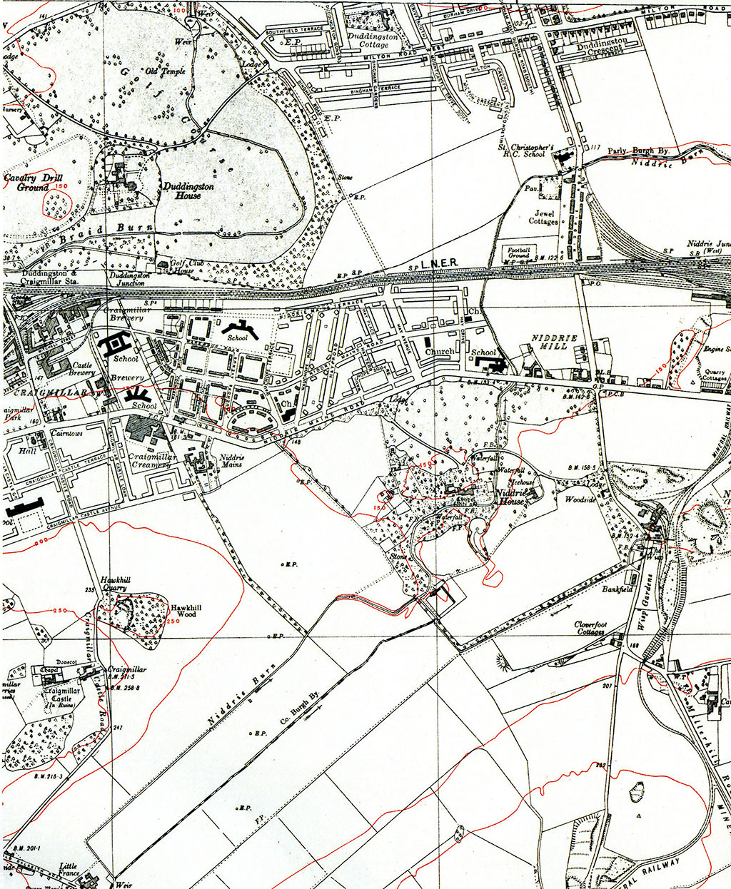
Ordnance Survey "As Simon Capeldi says in his Message 4 above, buildings at Bankfield appear on early Ordnance Survey maps. However, it looks as if Bankfield Cottages where Jean Kinnear lived (- see Recollections 2 above) may not have been built until some time after 1914. See the Ordnance Survey large scale maps below: - Map 2 ('25 inch', 1932) shows 8 houses which I assume are the cottages where Jean lived. They are near the upper-left corner of the map, (1932) below below shows a block of 8 houses at Bankfield in 1932. They are near the upper-left corner of the map, to the left of the word 'Bankfield. - Map 1 ('25 inch' 1914) however, shows no houses yet built in that location. - Map 3 and Map 4 ('6 inch', 1932 and 1938) zoom-out to show the position of Bankfield Cottages at The Wisp in relation to their surroundings. They are about one mile ESE of the then recently built (and now recently demolished) houses on the Craigmillar estate. |
Ordnance Survey
Map
'25 inch to 1 mile'
1914
Old shaft:
Gasometer: , Railway lines:
Bankfield without Bankfield Cottages
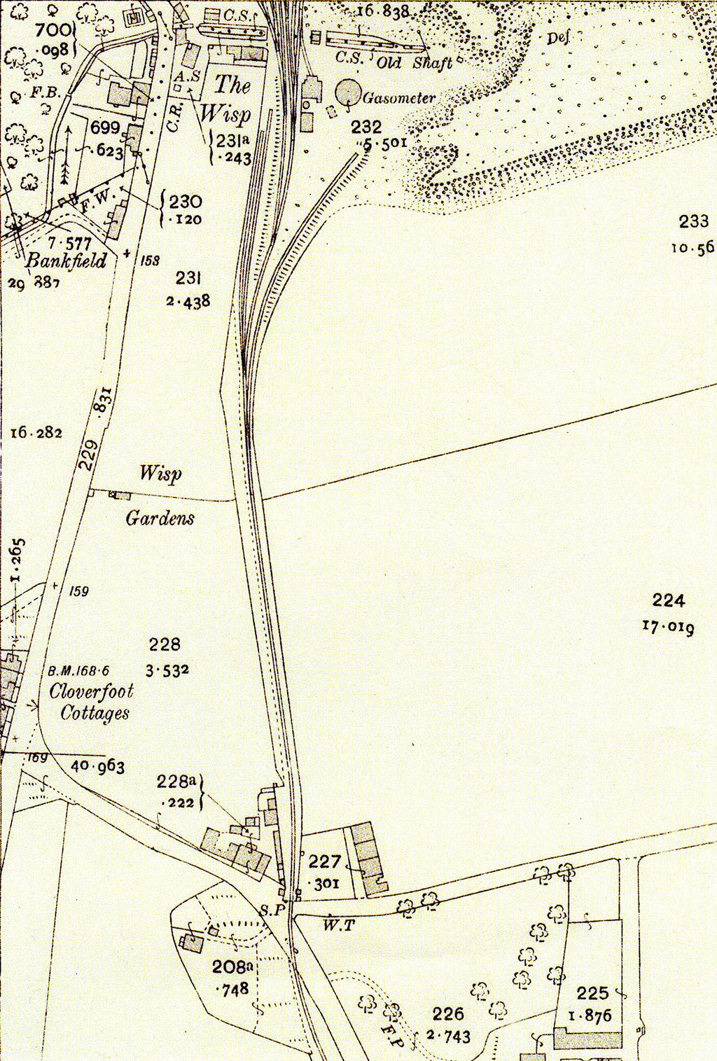
© Reproduced with acknowledgement to National LIbrary of Scotland Map Room
Ordnance Survey
Map
'25 inch to 1 mile'
1932
Old shaft (gone):
Gasometer (gone): Railway (re-aligned):
Bankfield including Bankfield Cottages
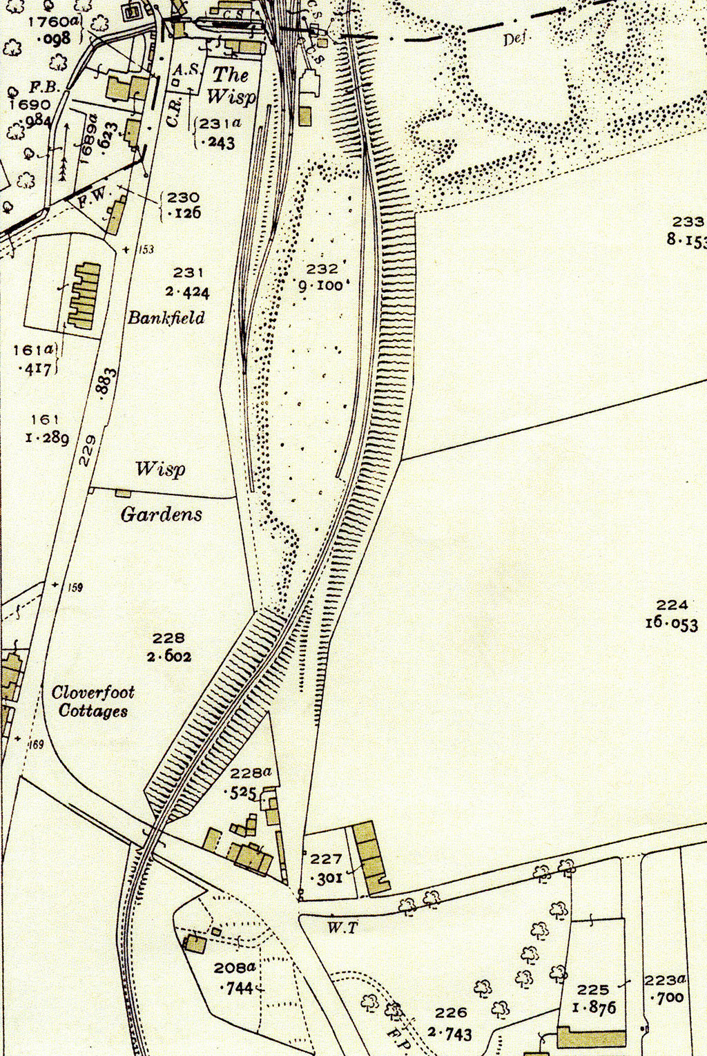
© Reproduced with acknowledgement to National LIbrary of Scotland Map Room
Ordnance Survey
Map
'6 inch to 1 mile'
1932
Bankfield Cottages are 2/3 of way down this map, near right-hand
side.
They are 1 mile ESE of Craigmillar and 1/2 mile SE of Niddrie
(empty fields + school)
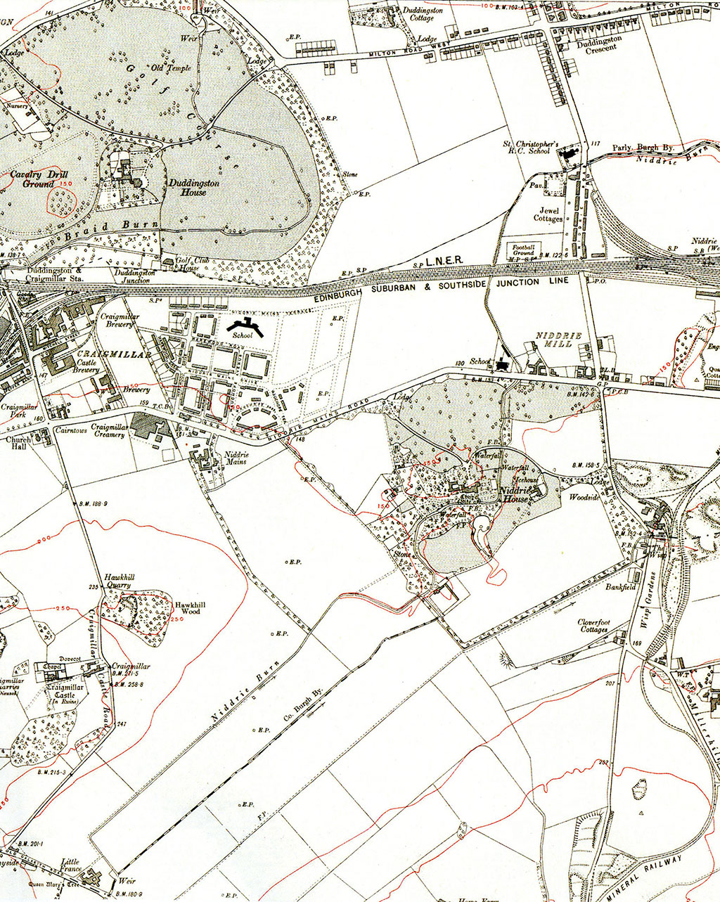
© Reproduced with acknowledgement to National LIbrary of Scotland Map Room
Ordnance Survey
Map
'6 inch to 1 mile'
1938
Bankfield Cottages are, again, 2/3 of way down this map, near right-hand side.
Houses are now planned for Niddrie and the school has been extended.
St Theresa's Chapel (mentioned by Jean Kinnear here) has been built at Niddrie.
© Reproduced with acknowledgement to National LIbrary of Scotland Map Room