|
Calton &
Broughton Major Developments Sculptures and Statues |
|
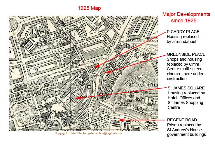
The map and aerial view below both cover the same part of Edinburgh, a relatively small area (approx 1/2 mile x 1/2 mile) immediately to the NE of Waverley at the East End of Princes Street. They show how the area has changed over the period since 1925. This follows a period of very little change as can be seen from this 1844 map. |
|
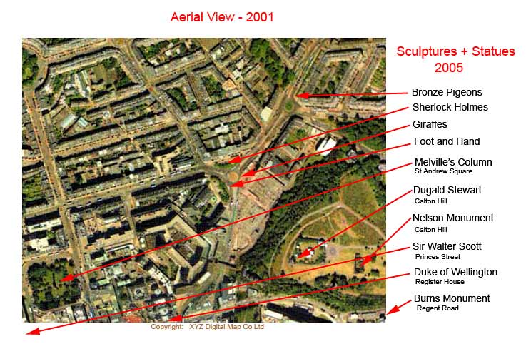
Please click on the text or map below and follow the links These refer to the parts of the map where there have been major changes since 1925. |
|
|
|
Please click on the text or map below and follow the links
These refer to: 1. the parts of the map
where there have been major changes since 1925 |
|
|