|
Edinburgh New Town
West End |
|
|
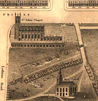
Kirkwood Map - 1819
©
Reproduced
by courtesy of the National Library of Scotland. |
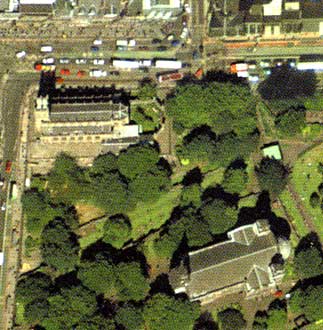
Aerial View - 2001
|
|
|
|
|
West End |
|
|
At the time that this map was drawn, these two churches at the West End of Princes Street stood beside the North Loch. They are: - St John's Church (described as St John's Chapel) - St Cuthbert's Church (described as West Church) There have been seven different churches on the site of St Cuthbert's Church since the 9th century. The Hall beside St Cuthbert's Church was used by Edinburgh Photographic Society to display its annual Open Exhibition of Photography each year from 1957 to 1979. The numbers of the houses at the West End of Princes Street can be seen along the top of the map Of the houses shown here, the following all became photographers' studios in the years up to 1900: Nos 131, 135, 137 and 143. |
|
|
Kirkwood Map - 1819 |