Newhaven 2001 |
|
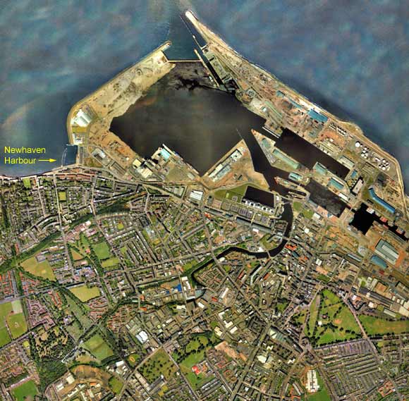
This map shows how Newhaven harbour is now almost lost beside the enlarged Leith Harbour. Leith Harbour is currently being re-developed with the building of a shopping complex (Ocean Terminal), the Scottish Office, hotel, sports complex, housing, etc. Immediately to the East of Newhaven Harbour is the old fishmarket, now split into three parts - a smaller fishmarket, still in use - a heritage museum, which unfortunately closed in 2006. - Harry Ramsden fish restaurant. (Now closed, and re-opened as a Loch Fyne restaurant.) The many railways that could be seen on the 1917 map have closed, most several decades ago. But their tree-lined courses can still be picked out on the 2001 aerial photo. |
This aerial view is detail taken from a photo by XYZ Digital Map Company Limited.
|
|
|
earlier map later map zoom-in zoom-out |
© Copyright: XYZ Digital Map Company Limited. Click here for details of web site.
|
MAPS: Full index |
|
MAPS: Short Index with thumbnails |