Edinburgh - 1928 Map |
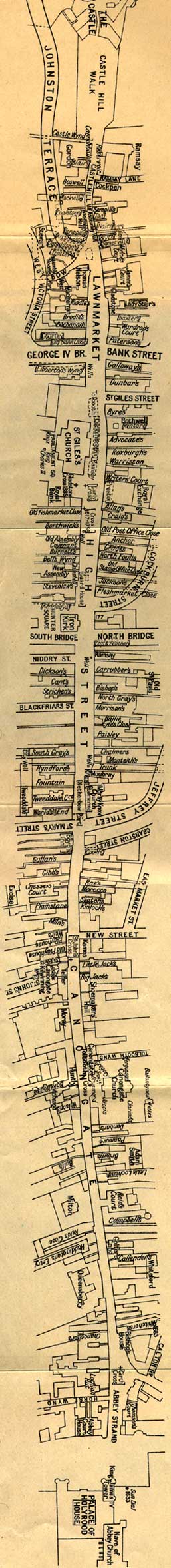
The map below is taken from the book, The Royal Mile, by Robert T Skinner. This book was published in 1928, and also includes some photographs and line drawings of the closes in the Royal Mile. The map below is long and narrow. You will have to scroll down the page to see it all. Please be patient. This map is quite large, and may be slow to load. If I had used a smaller map, you might have had difficulty reading the names of all the closes. |
|
|
©
Copyright:
For
permission to reproduce,
please contact peter.stubbs@edinphoto.org.uk
|
MAPS: Full index |
|
MAPS: Short Index with thumbnails |