|
Edinburgh Castle to Holyrood Palace |
|
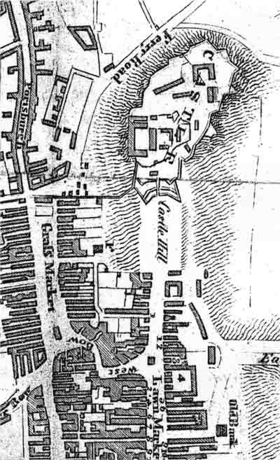
Edinburgh Map The map below shows the route of the Royal Mile, leading down the hill from Edinburgh Castle to Holyrood Palace - the road on the right of this map, leading from top to bottom.. This map appeared in an Edinburgh guide book of 1817. The narrow lanes, or closes, on the Royal Mile have all been numbered. Please click here to see a key to the numbers. |
© Reproduced by courtesy of Edinburgh City Libraries and Information Services
|
|
|
|
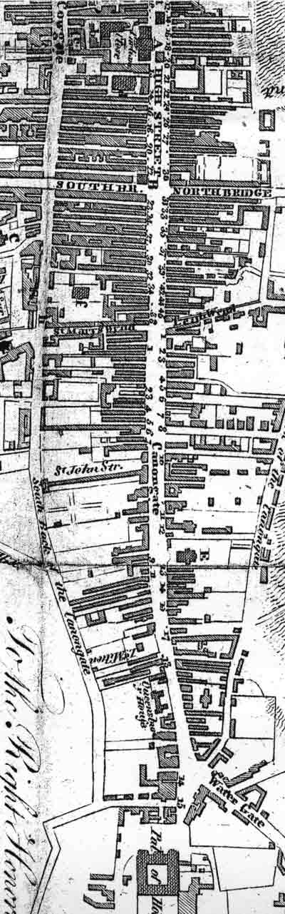
© Reproduced by courtesy of Edinburgh City Libraries and Information Services
|
MAPS: Full index |
|
MAPS: Short Index with thumbnails |