|
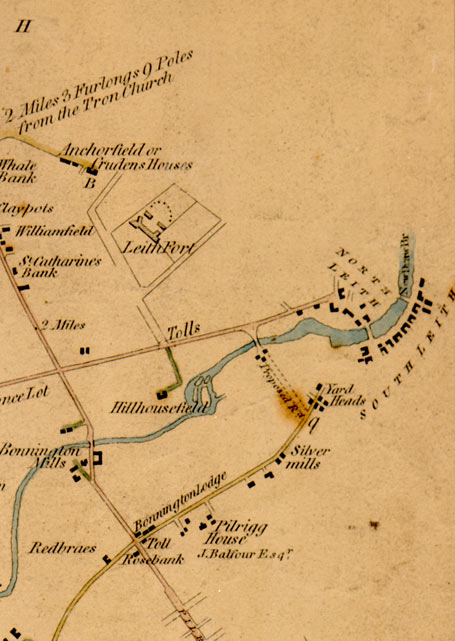
Edinburgh & Leith TOP RIGHT SECTION 1812 from a map showing roads within and connected to Cramond. |
© Copyright: For permission to reproduce, please contact peter.stubbs@edinphoto.org.uk
|
Map showing roads within and connected to Cramond. 1812 |
|
Here is an enlargement of the top right hand portion of Edinburgh & Leith section of a map surveyed in 1812. - This map covers an area extending along the southern shore of the Firth of Forth (not marked) from Newhaven past the old Leith Fort to Leith. It extends and as far south as Bonnington Toll, which is about mid-way between Leith and Edinburgh - Newhaven is shown as being a distance of 2 miles, 3 furlongs, 9 poles from the Tron Church in Edinburgh's Royal Mile. In 1812, there appear to have been no road directly linking Newhaven and Leith along the shore of the Firth of Forth. - The course of the Water of Leith is clearly shown as it approaches Leith from the south-west. |
|
MAPS: Full index |
|
MAPS: Short Index with thumbnails |
