|
Edinburgh & Leith 1812 from a map showing roads within and connected to Cramond. |
|
|
|
later map zoom-in to ... top left top right bottom left bottom right |
© Copyright: For permission to reproduce, please contact peter.stubbs@edinphoto.org.uk
|
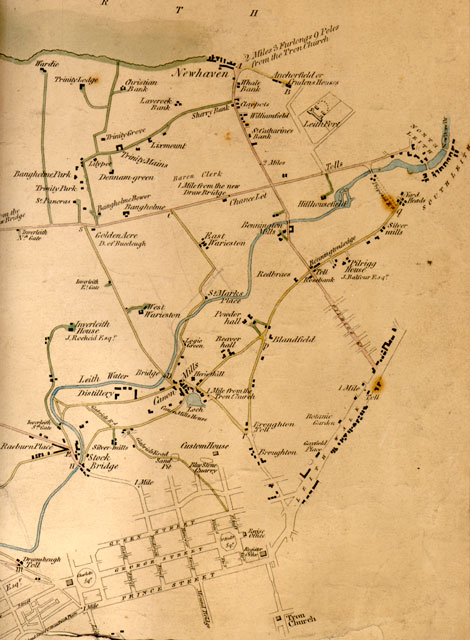
Map showing roads within and connected to Cramond. 1812 |
|
Here is the right hand third of a map surveyed by John Leslie & Son in 1812. The whole map shows the lengths of roads within and connected to Cramond District. This is the right hand third of the map - the part that includes most detail. This section of the map shows the southern shore of the Firth of Forth from Wardie (close to where Granton Harbour was built in the 1830s) to Newhaven, described on the map as being 2 miles, 3 furlongs, 9 poles from Tron Kirk. The map gives the lengths of thirty roads. Each has been measured in roods and yards (1 rood = 7 yards). Please click here to see examples of road distances. This map includes some interesting details: - several tolls - a loch, sand pit and a quarry - a fort These details can be seen more clearly by zooming-in to top left, top right, bottom left or bottom right. |
|
MAPS: Full index |
|
MAPS: Short Index with thumbnails |