|
South-East Edinburgh 1955 |
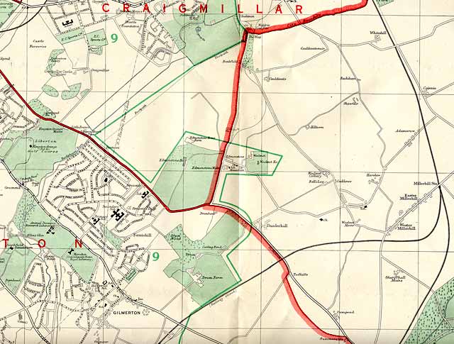
© For permission to reproduce please contact peter.stubbs@edinphoto.org.uk Extract from a map by Bartholemew, 1955-56
|
South-east Edinburgh 1955 Map Comments |
|
Thank you to David Bain for noticing some discrepancies between this Bartholemew map and the streets that were actually built David wrote: |
|
Discrepancies in the Map "I've just looked at the 1955 map in connection with the explosives factory thread, and I'm sure most of the Moredun estate is pure guesswork! Schools are in the wrong place and there are streets shown: - Craigour Gardens - Craigour Drive which were fields and a farm in 1958. I wonder if the cartographers got a quick look at the corporation's projects book and decided to save time." David Bain, Rotherham, South Yorkshire, England: October 8, 2011 |
|
The discrepancies that David mentions can be seen by comparing this enlarged map with a modern street atlas of the area. Peter Stubbs, Edinburgh: October 8, 2011 |
|
Maps: All Edinburgh Districts: 1870 1915 1925 1940 1955 2001 |
|
|
Map Index: Full Index |
Map Index: Short Index + thumbnails |