|
Redford 1940 |
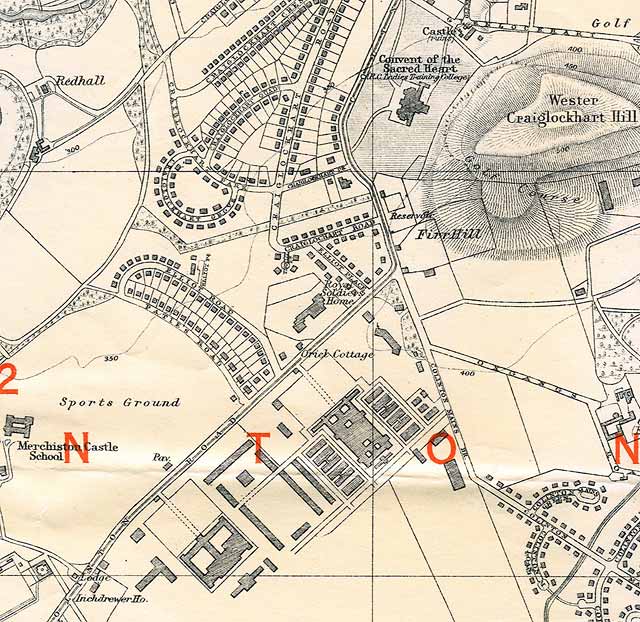
The large blocks of buildings in the
lower part of this map in the triangle between
Colinton Road and Colinton Mains Drive are Redford Barracks
© For permission to reproduce please contact peter.stubbs@edinphoto.org.uk Extract from a map by Bartholemew, 1940-41
|
Redford Map |
|
Redford Barracks The large blocks of buildings in the lower part of this map in the triangle between Colinton Road and Colinton Mains Drive are Redford Barracks. Bob Wyllie, now living in Brussels, Belgium, has asked a question about the thin strip of woodland in the centre of this map. He has been told that this was once the course of a railway that was used to bring stone for the construction of Redford Barracks. He is keen to discover more about this railway. Please click on the link below to read Bob's comments |
|
Maps: All Edinburgh Districts: 1870 1915 1925 1940 1955 2001 |
|
|
Map Index: Full Index |
Map Index: Short Index + thumbnails |