Links to a few pages on EdinPhoto web site
Home Page + Search
Latest Updates
Index: More Pages
Edinburgh Views
Edinburgh Maps
Leith
Recollections
Clubs + Discos
Transport
Photographers
Early Photography
Edin Photog Soc
Monopoly Board
email me
Other Web Sites
This site, like many others, uses cookies. See more details here.
Please choose: 1. YES: I agree to the use of cookies. 2. NO: I do not agree.
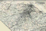
Maps of Edinburgh
1925
©
LARGE
NW N NE W E SW S SE Central
- Braid Hills
- Craiglockhart
- Craigmillar
- Dumbiedykes
- Gilmerton
- Granton
- Inverleith
- Juniper Green
- Leith
- Liberton
- Niddrie
- Portobello
- St Leonards
- Slateford
- Waterfront
- Zoom-out
- whole city
- whole city (very large)
- whole city (+ proposed tramline)
SMALL
Thumbnails
- Leith Links
More Maps: Map Index Thumbnail Maps
__________________ Links to a few pages on EdinPhoto web site Home Page + Search Latest Updates Index: More Pages Edinburgh Views Edinburgh Maps Leith Recollections Clubs + Discos Transport Photographers Early Photography Edin Photog Soc Monopoly Board email me Other Web Sites
__________________