|
Gypsy Brae |
© For permission to reproduce please contact peter.stubbs@edinphoto.org.uk Extract from a map in the Post Office Directory, 1925-26
© Copyright: XYZ Digital Map Company Limited. Click here for details of web site.
|
Gypsy Brae |
|
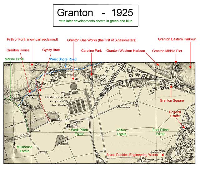
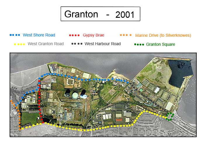
I have marked Gypsy Brae with red dots on the 1925 map and on the 2001 view of Edinburgh Waterfront, above. When map was drawn in 1925, Gypsy Brae was the only road down to the Firth of Forth in this area. It ran between Granton Gas Woks and Granton House, about a mile to the west of Granton Harbour. Around the mid-1900s. - West Shore Road was built (blue dots above) - Some land was reclaimed from the Firth of Forth, N of this road. - Marine Drive was built (green dots above) leading to Silverknowes - Gypsy Brae was closed (red dots above). It became enclosed within an enlarged Granton Gas Works' site. Granton House, immediately to the west of Gypsy Brae, was destroyed in a fire on 1 January 1954. |