|
St Leonard's District Photos Photo 10 Dumbiedykes Road See Answer below |
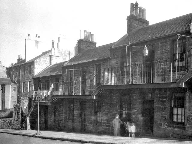
© Reproduced with acknowledgement to David Gordon, Old Town, Edinburgh
|
St Leonard's District - 1920s |
|
Collection of Photos The image above is taken from a collection of whole-plate negatives. The photos were probably taken around the 1920s. If you recognise this street, please email me. Thank you. Peter Stubbs: July 5, 2008 |
|
Answer |
|
Thank you to Neil Lawrence, Fountainbridge, Edinburgh, who wrote: |
|
Dumbiedykes Road "Here is another one that you can cross off the list The number above the door was the give-away here. There were only about 6 street in Edinburgh that went up and past number 133. Two were in the south side, Dumbiedykes Road and Causewayside – a quick look at the old maps and it turns out to be Dumbiedykes Road." Neil Lawrence, Fountainbridge, Edinburgh: July 10, 2008 |
|
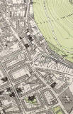
Neil also sent me a copy of an old large-scale map, showing that No 133, the house on the right in the photograph above, is on the east side of Dumbiedykes Road between Brown Street and Carnegie Street. Also in this section of the road, a little further south, there was a pub at No 143. |
|
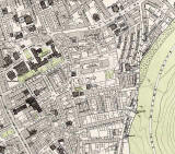
1891 Map Dumbiedykes Road can be found running down the Dumbiedykes map below, close to the right-hand side of the map. |