|
Map of the area around Gilmour House
Extract from Ordnance Survey |
formerly Gilmerton House
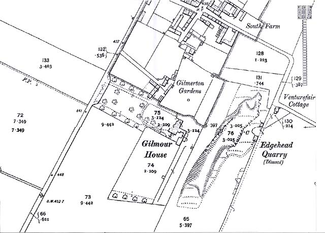
© Reproduced with acknowledgement Mapman
|
Gilmour House |
|
Maps Thank you to Mapman for allowing me to reproduce the map above and also an earlier map. Please click on the thumbnail image below to see the earlier map: |
|
Please click here to read read Recollections of Gilmerton |
|
MAPS: Full index |
|
MAPS: Short Index with thumbnails |