Royal Mile ClosesMid-1700s |
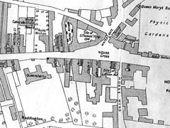
'Edinburgh in the Mid-Eighteenth Century'
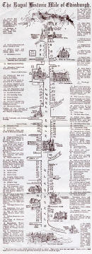
Extract 1 from map, including closes near Holyrood at the foot of Canongate

©
Reproduced with acknowledgement to John
Dickson, Royston, Edinburgh
Map
drawn by Henry F Kerr in 1918 and published in The Book of the Old
Edinburgh Club, Vol XI, 1922.
'Edinburgh in the Mid-Eighteenth Century'
Extract from map, including closes near Nether Bow Port at the top of Canongate
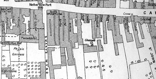
©
Reproduced with acknowledgement to John
Dickson, Royston, Edinburgh
Map
drawn by Henry F Kerr in 1918 and published in The Book of the Old
Edinburgh Club, Vol XI, 1922.
|
Royal Mile Closes |
|
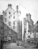
These maps were added to the EdinPhoto web site during a discussion of the view in this etching by Robert Smith Forrest. In fact, the etching is of Chessel's Court. opposite New Street, just below where Nether Bow Port once stood in Canongate. |
|
MAPS: Full index |
|
MAPS: Short Index with thumbnails |