|
Turnhouse Aerodrome Now Edinburgh Airport |
Picture
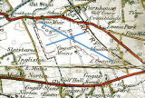
1.
1923 OS Map
© Reproduced with acknowledgement to Colin Lourie, Stockbridge, Edinburgh
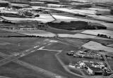
2.
1966 Aerial View
© Reproduced with acknowledgement to the Royal Commission on Ancient & Historical Monuments of Scotland (RCAHMS)
|
Turnhouse Aerodrome |
|||
|
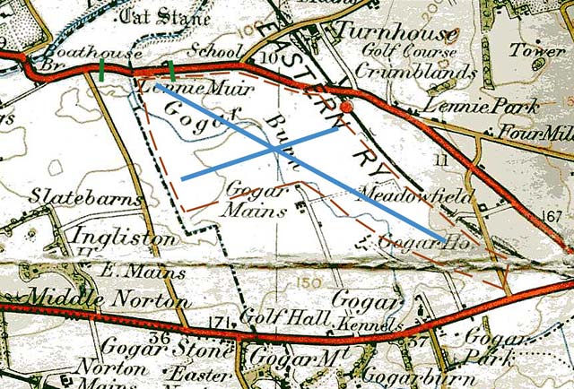
Thank you to Colin Lourie for sending me this Ordnance Survey map, published in 1923. Colin sent this map following discussion on the Edinburgh Airport recollections page about whether or not the A9 Edinburgh-Kirkliston road actually crossed the runway at Edinburgh Airport. |
|||
|
Colin wrote: Picture 1. 1923 OS Map "The road coloured red in the top half of this map is the A9 Edinburgh-Kirkliston road. I've also annotated this map to also show: - BLUE LINES: The positions of the old runways in the 1960s. - BROWN DOTTED LINE: The full airfield boundary. - GREEN BARS: Location of the barriers used to stop traffic when aircraft were landing (or taking off, depending on the wind direction)." |
|||
|
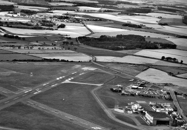
Colin added: Picture 2. 1966 Aerial View "There is no doubt in my mind that the line of road in the 1960s was the pre-existing line, ie the route of the road was never changed to accommodate the runway (and the road never crossed the runway). This is borne out by Photo 2 above, taken in 1966. As the A9 from Kirkliston passes through the centre of this photo, heading towards the lower-right corner, it makes a turn towards, not away from, the runway. The dark line running almost horizontally across that photo is the (realigned) Gogar Burn. There was a bridge where the A9 crossed it on the S-bend in the middle of the photo. It was from there that I took the photos of the Viscount and the Canberra landing at the airport." Colin Lourie, Stockbridge, Edinburgh: November 23, 2011 |
|||
|
Edinburgh from the Air This aerial photo, but extending a little further at the bottom to include more of the airport, also appears on in Malcolm Cant's book, Edinburgh from the Air. The photo, together with a key to some of the airport landmarks is on page 164 of the book, followed by comments about the photo and the airport from Malcolm Cant. |
|||
|
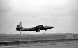
More Photos Thank you to Colin for also for allowing me to reproduce these photos that he took at Edinburgh Airport in the 1960s.
Note: Colin Lourie has taken many photos of planes at Edinburgh Airport in the 1960s. Some of his photos have now been included in Keith McCloskey's book 'Edinburgh Airport: A History'. |