|
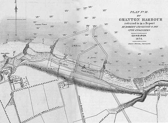
One of the Plans for Granton Harbour 1834 |
© Reproduced with acknowledgement to Buccleuch Estates and to Argyll Publishing

|
One of the plans for Granton Harbour 1834 |
|
Plans in 1830s In the 1830s, when this plan was drawn, there was discussion as to whether the new deep water harbour, urgently needed for Edinburgh, should be built at: - Leith which already had docks - Newhaven, where there was an Old Chain Pier or - Granton. The decision was made in favour of Granton, where an Eastern and Western Harbour were built, separated by a central pier, but not quite in accordance with the plans above. |
|
This 1834 plan above includes: Harbours - Western Harbour (24 acres) with dock beside the shore (6.25 acres) - Eastern Harbour (11 acres) with dock beside the shore (6.25 acres) In fact, when the harbour was built, the work being carried out from 1836 onwards, it was considerably larger - West Harbour 69 acres, East Harbour 52 acres, but no inner docks. The harbour that was built extends further to the east along the Firth of Forth than on the plan above. The Eastern Breakwater of the harbour now meets the shore at a point close to where Wardie Burn enters the Firth of Forth. |
|
This 1834 plan above includes: Railways and Canals - A railway to the east, to Leith, through a tunnel approximately under where Boswall Road was built. - A railway to the south, to join the Union Canal at Fountainbridge. A railway was built to the east, but not to Leith. It was built on an embankment along the Firth of Forth from Middle Pier, Granton Harbour along an embankment beside the Firth of Forth, to Trinity Station, close to Newhaven Old Chain Pier, then it swung to the south towards the centre of Edinburgh. Another railway (Caledonian Line) was built to Granton Harbour from the west. But no line was ever built heading to the south (up the hill) from Granton Harbour. I have seen an old plan titled 'Granton Made Magnificent' on which it was proposed to build a canal heading to the south from Granton Harbour, through a series of locks, and on to meet the Union Canal. However, the importance of canals diminished rapidly in the 1830s and 1840s as more railways were built, and the proposal to link the Union Canal to the Firth of Forth at Granton was never carried out. |
|
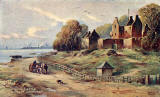
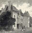
his 1834 plan above includes just a few buildings: Buildings - Granton Castle (extreme left on the map) Granton Castle, or Granton House as it was formerly known, was standing beside the Firth of Forth in 1479. The castle lay in ruin for many decades, then was demolished in 1928 when the land on which it stood was bought be a firm of quarriers. - Caroline Park (beside Granton Castle) Caroline Park dates from around 1585. It is still standing and is now in private ownership - Cottage (centre of map) I have not yet discovered which cottage this was. I believe that it was probably demolished some time ago. - Wardie (extreme right of map) This building became Challenger Lodge, and more recently, St Columba's Hospice. - House (beside Wardie). This building is Wardie House, a large house dating from around 1666. Most of the house was demolished in the 1950s, when it was in a poor state of repair. One corner of the old house has survived and is now in private ownership. |
|
MAPS: Full index |
|
MAPS: Short Index with thumbnails |