Begbie photos: Old Town New Town Around Edinburgh Leith Stereo |
Thomas Vernon BegbiePhotographs from the 1850s |
|
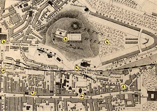
This page will display a map the eastern part of central Edinburgh. The yellow circles will show where Thomas Begbie stood to take several of his photos. The arrows within the circles will show the direction he was facing. Please click on the arrows to see the photographs that he took. Most of these photos were stereo pairs, but on this site I have normally shown just a single image from the pair. This map may be slow to load, so please wait until it appears. Thank you. |
Photographs from the 1850sby Thomas Vernon Begbie |
|
to the east of the North Bridge
© Copyright: For permission to reproduce, please contact peter.stubbs@edinphoto.org.uk |
BEGBIE: MAPS & PHOTOS Key Central Edinburgh (west) Central Edinburgh - (east) Edinburgh & Leith |
|
Note
on maps of |
|
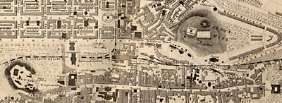
The map above is the right hand side of this image below which includes: - top left - Edinburgh New town - top right: Calton Hill - bottom left: Edinburgh Castle - bottom right: Holyrood
|
Please see below for links to other Begbie pages:
|
Thomas Vernon Begbie |
|
MAPS & PHOTOS: Key Central (west) Central (east) Edinburgh & Leith |
|
PHOTOS: Stereoscopic Old Town New Town Around Edin Leith Sculptures |
|
BEGBIE STORY: Discovery Family Partnership Amateur Studios Collections |
|
MAPS: Full index |
|
MAPS: Short Index with thumbnails |