Queensferry to Musselburgh
|
|
© Copyright: For permission to reproduce, please contact peter.stubbs@edinphoto.org.uk
![]() Enlarge this
map
This is a large map that may be slow to load.
Enlarge this
map
This is a large map that may be slow to load.
zoom-in on the same map to Edinburgh & Leith: 1884
zoom-out on the same map to the whole of Edinburghshire: 1884
|
Queensferry to Musselburgh |
||||||
|
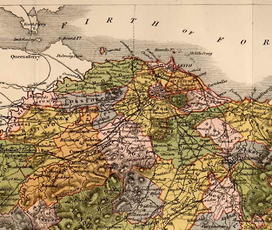
Below is part of a map of Edinburghshire that appeared in The Ordnance Gazetteer of Scotland, 1884. It shows Edinburgh and surrounding land, together with the coast of the
to Musselburgh. |
|
Counties |
|
The two white areas, upper left on this map are parts of: - Fife (on the north of the Firth of Forth) - Linlithgowshire (on the south of the Firth of Forth) The City of Edinburgh now extends as far west as Queensferry. This map was engraved by by WH Lizars and was published in 1884 |
|
MAPS: Full index |
|
MAPS: Short Index with thumbnails |