|
Edinburgh Old Town High Street - Cowgate - South Bridge |
|
|
|
earlier map later map zoom-out to Old Town zoom-out thumbnail images |
© Copyright: For permission to reproduce, please contact peter.stubbs@edinphoto.org.uk
|
High Street - Cowgate - South Bridge |
|
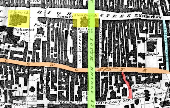
The map above is taken from a map of Edinburgh included in the Edinburgh General Post Office Directory, 1830-31. There has been little change in the streets in this area since the map was drawn, other than that some of the narrow closes now no longer exist. On this map, the roads running across the map (approx east-west) are: - High Street (part of the Royal Mile) - St Giles Church and the Tron Kirk (or Church) shown in yellow. - Cowgate running in the valley to the south of the High Street. Cowgate passes under South Bridge |
|
South Bridge (known as South Bridge Street when this map was published) runs north-south, through the centre of the map. The two small lanes (or winds) that I have coloured on this map are: - St Mary's Wind leading into Cowgate from the north and - High School Wind (probably! This lane is not named on the map) leading into Cowgate from the south. |
|
MAPS: Full index |
|
MAPS: Short Index with thumbnails |