|
Edinburgh - Boundaries |
|
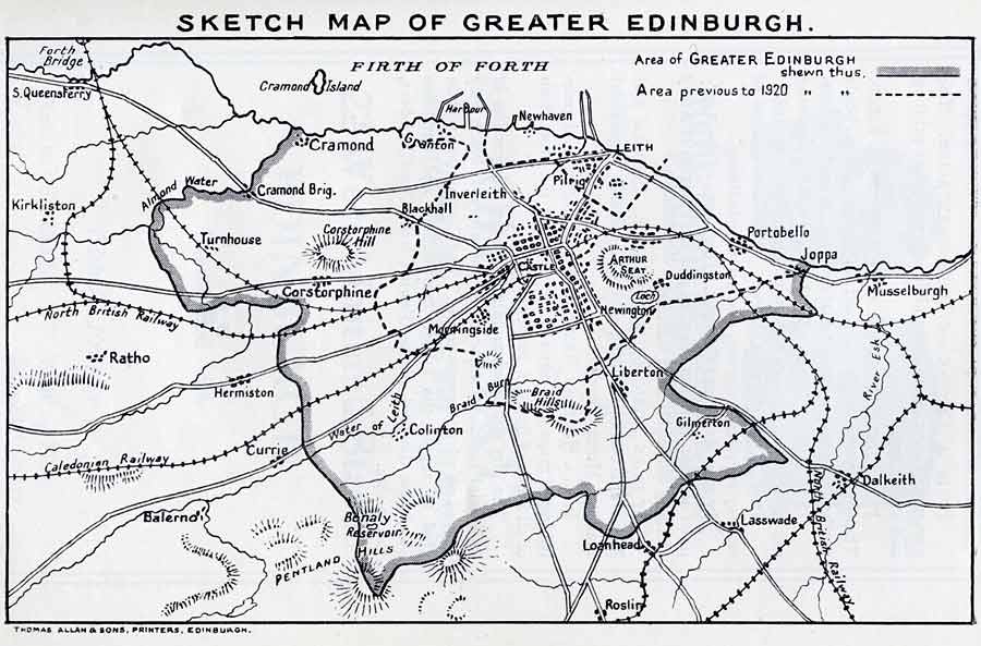
The boundaries before and after 1920 are shown on this map. The map was published in the Edinburgh Official Guide, 1923, three years after the boundaries of Edinburgh were expanded to create Greater Edinburgh. |
Please scroll down and across to see this map
|
|
© Copyright: For permission to reproduce, please contact peter.stubbs@edinphoto.org.uk - Published in 'Edinburgh Official Guide', published by the Authority of the Magistrates and Council, 1923
|
Add Dalmeny Estate to this map |
|
MAPS: Full index |
|
MAPS: Short Index with thumbnails |