|
Leith Links 1915 |
Leith Links - 1915
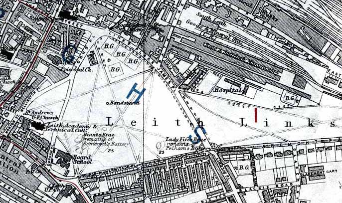
© For permission to reproduce please contact peter.stubbs@edinphoto.org.uk Extract from a map in the Post Office Directory, 1925-26
|
Leith Links |
|
History Leith Links is an open area of grass to the east of the Foot of Leith Walk. It is still used for sports and is believed by some to be where the game of golf was first played. On this map, Leith LInks can be seen, lying between: - South-west corner: Leith Central Station. - North-east corner: Leith Ropery and the railway lines in Leith Docks. |
|
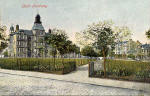
There were two schools close to the south-west corner of Leith Links. Primary School The school marked 'Leith Academy & Technical College' on this map became Leith Primary School. Thank you to Norma Brodie, Auckland, New Zealand for identifying this school in the postcard view above. Norma was a pupil at the school from 1946. Secondary School The other school near the south-west corner of Leith Links, marked 'Board School' on this map became Leith Academy Secondary School. In recent years, the building has been used by Queen Margaret University College, but it is now [in 2005] for sale. It is expected to be developed as housing or as a hotel when the college moves to its new site at Musselburgh in 2007. |
|
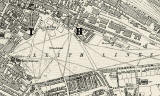
This map shows the same area 10 years later. The two schools above are in the same positions, but with different names! Leith Links - 1925 |
|
Maps: All Edinburgh Districts: 1870 1915 1925 1940 1955 2001 |
|
|
Map Index: Full Index |
Map Index: Short Index + thumbnails |