|
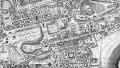
Edinburgh Castle to Calton Hill Please scroll down to see other dates and sizes of map |
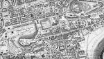
Zoom-in to the area around Edinburgh Castle
© For permission to reproduce, please contact peter.stubbs@edinphoto.org.uk
|
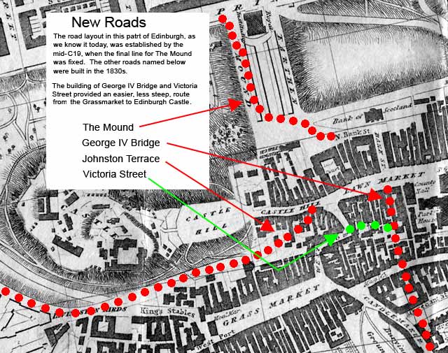
Route from the South to Edinburgh Castle |
|
|
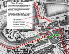
This detail from an 1830 map of Edinburgh shows the steep route from the Grassmarket, up West Bow, to Edinburgh Castle. It also shows, marked with red and green dots, the positions of new roads yet to be built. The route from the Grassmarket to Edinburgh Castle when this map was drawn, was up the steep West Bow with it's double bend, but during the 1930s, Victoria Street (green) was built giving a gentler slope to George IV Bridge, then up the Lawn Market and Castle Hill to Edinburgh Castle. Please click on the image below to see this map without the new road and key.
|
|
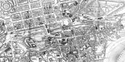
More Maps Larger maps show more detail, but will be slower to load |
|||
|
Edinburgh Castle to Calton Hill |
|||
|
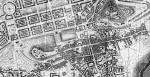
1830 |
1830 |
1830 |
|
|
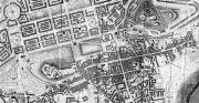
1840 |
1840 |
1840 |
|
|
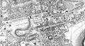
1848 |
1848 |
1848 |
|
|
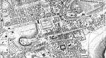
1865 |
1865 |
.
1865 |
|
|
Notes It can be seen from the maps above that: - between 1830 and 1840: - George IV Bridge built. - Victoria Street built to the east of West Bow - not yet named on the map. - New West Approach built south of the castle - now named Johnston Terrace. - between 1840 and 1848: - Railway built through Princes Street Gardens. - between 1848 and 1865 (in fact, soon after 1948): - The second Gallery at the foot of the Mound built . - The Mound built . |
|||
|
Edinburgh Castle |
|||
|
zoom-in |
zoom-in |
||
|
All the images above are taken from the folding maps in Post Office Directories. These maps were engraved by C Thomson (1830), W H Lizars (1840,1848), John Bartholemew (1865). I have copied the same area of land each of these maps but some of the images are squarer than others. - The scales on the W H Lizars maps show this area to be approx. 1.25 miles x 0.75 miles. - The scale on the John Bartholemew map shows this area to be approx.1.50 miles x 0.75 miles. - The C Thomson map has no scale, but the proportions are similar to the John Bartholemew map. - The modern Ordnance Survey map shows this area to be approx.1.50 miles x 0.75 miles. |
|||