|
Looking down on Eastern Breakwater Granton |
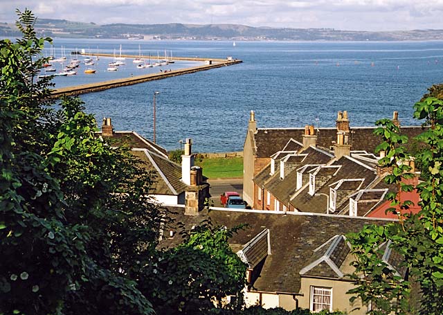
© Copyright: Peter Stubbs - please contact peter.stubbs@edinphoto.org.uk Photograph taken 6 October 2002
|
to to see the small group of figures on the breakwater |
|
Looking down on Eastern Breakwater Granton |
|
This view looks down from Granton Road, over the houses in Wardie Square, to the Eastern Breakwater of Granton Harbour, on a fine autumn day. The road running along the shore, just visible beyond the two cars is Lower Granton Road. The grass strip beyond the road is where the old railway embankment for the line to Granton Harbour used to be before the land was levelled. |
|
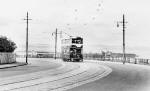
Off the left hand side of the picture above, the land slopes down the hill from Granton Road to the backs of the houses on the south side of Wardie Square (behind the tram in the photograph below). . I have been told by a former resident of Wardie Square (1972 to 1994), now living in Ho Chi Minh City, Vietnam, who used to spend a lot of time playing on Granton Beach and climbing trees on the land that sloped down from Granton Road to Wardie Square, that this slope used to be known by the kids as the 'Nanny Park', apparently because nanny goats used to be kept there. |