Caroline Park Grove Houses Demolished |
Bus Stop, West Granton Road - August 2006
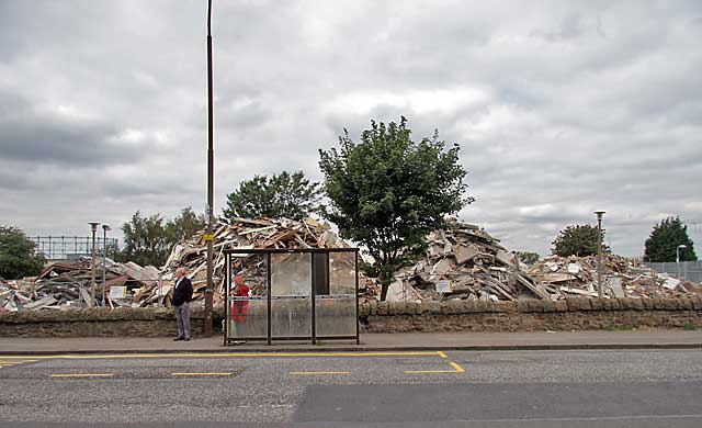
© peter.stubbs@edinphoto.org.uk Photograph taken August 22 2006 at 1.15pm
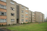
Caroline Park Grove |
|
This view looks to the north across West Granton Road. The framework of the last of Granton's three gasometers can be seen at the extreme left of the picture. The rubble in the background behind the bus shelter, is the remains of these houses in Caroline Park Grove: |
|
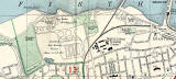
Immediately to the left of these houses, was a small street, also named Caroline Park Grove. It can be seen on the 1955 map below, leading into the area then labelled 'Ministry lf Labour Training Centre'. Please click on the map below to enlarge it: |