|
Aerial View of Newhaven |
Aerial View - 1978
© Scotsman Publications Ltd Click here for web site details Licensor: www.scran.ac.uk Ref.000-000-54-726-C Scotsman 913833
© Scotsman Publications Ltd Click here for web site details Licensor: www.scran.ac.uk Ref.000-000-54-726-C Scotsman 913833
|
Aerial View of Newhaven |
|
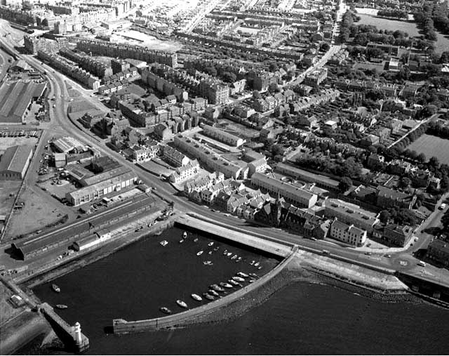
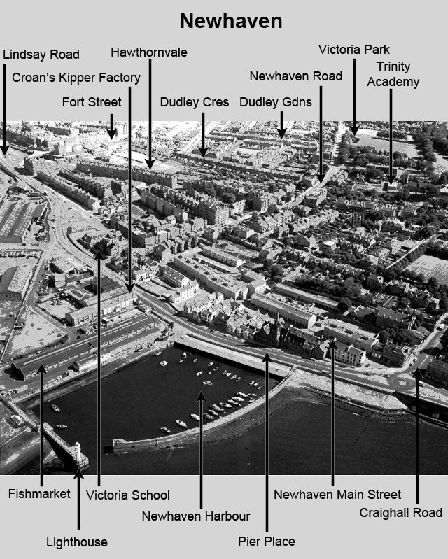
1978 This aerial photograph of
Newhaven was taken on August 11, 1978. Old and New Roads The main road through Newhaven used to be Newhaven Main Street (continuing west as Anfield). The buildings to the north of this road, including Victoria Primary School, The Peacock Inn and the church, now Alien Rock climbing centre, used to face directly onto the sea on their northern side. Then a new road, Pier Place (continuing west as Newhaven Place, Anchorfield and Lindsay Road) was built. Old and New Roads In the 1990s: - the southern end of Newhaven Fishmarket was converted to a restaurant, formerly Harry Ramsden's, now Loch Fyne. - the central part of Newhaven Fishmarket was converted to create Newhaven Heritage Museum, now closed. Another restaurant has opened in the central part of the old fishmarket. Is Newhaven Heritage Museum likely to open again? - Croan's kipper factory at Newhaven, and another kipper factory immediately to the east of it closed. Croan's moved to a new factory at West Shore Road, Granton. That has now also closed. - Housing was built on the site of the old kipper factories. Since 2000: - Much of the old industry, seen on the extreme left of this photo has been removed to make way for the area to be developed for housing as part of the Edinburgh Waterfront development. - A new ASDA Supermarket has been built and is now open 24 hrs. It has been built on a site just off the left-hand side of this photo. |
|
MAPS: Full index |
|
MAPS: Short Index with thumbnails |