|
Pictorial Map of Edinburgh - 1954 Published in 'The Story of Bruce Peebles, 1866-1954' |
|||
|
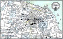
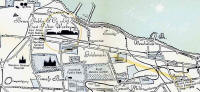
1. The whole map - Edinburgh showing Bruce Peebles works, 1866-1954 |
|||
|
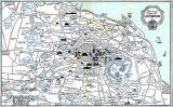
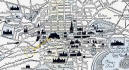
2. Zoom-in to North Edinburgh showing Bruce Peebles works, 1898-1954 |
|||
|
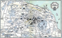
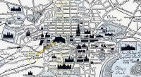
3. Zoom-in to Central Edinburgh showing Bruce Peebles works, 1866-1898 |
|||
|
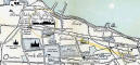
Note - 1954 Map I have described this map as '1954', but it may, in fact be a little earlier. Holyrood Park on the map is named, 'King's Park'. The name of the park may well have changed to 'Queen's Park' in 1952 or 1953. |
|||